| SECOND PERIOD |
| (1803-1825) |
| AMERICAN OCCUPATION. |
| Oklahoma in the United States. —The Louisiana country was formally delivered to the representatives of the United States Government in 1803 and 1804—New Orleans, December 20, 1803, and St. Louis, March 10, 1804—but it was more than two years before any of the country which is now known as Oklahoma was visited by officials of the Government. Within the twenty years following, however, Oklahoma was visited by several exploring expeditions and within its limits there were planted two military posts, or forts, which were garrisoned by United States soldiers. There were also several fur trading posts and at least one missionary station established during that period. |
The Sparks Red River Expedition.— In May, 1806, a small force, consisting of twenty soldiers and four civilians, under the command of Capt. Richard Sparks, attempted to ascend the Red River, from Louisiana, in boats. It was the purpose of the expedition to visit the country of the Pawnee Pique (Wichita) Indians. Unfortunately, just about the time that Captain Sparks and his little band of explorers reached the southeastern part of the present state of Oklahoma, they were met by a large force of Spanish troops under the command of Capt. Francisco Viana (fran-ces’-co ve-a’-na) which opposed further progress, so the expedition had to be abandoned.
The Sparks Expedition was only a part of a general scheme for the exploration of the newly acquired Louisiana country. Almost simultaneous with it were the expeditions of Lieut. Zebulon Montgomery Pike in the valleys of the Kansas and Arkansas rivers, and of Captains Meriwether Lewis and William Clark, whose little band of intrepid explorers ascended the Missouri to its source, crossed the continental divide and descended the Columbia to its mouth, and then returned in safety, though enduring great hardships. |
| Wilkinson’s Descent of the Arkansas. —Late in the summer of 1806 an expedition under the command of Lieut. Zebulon M. Pike, left St. Louis to explore the regions of the Great Plains and the Rocky Mountains. After visiting the Osage and Kansas Indians in Missouri and Eastern Kansas and the Pawnee Indians on the Republican River a short distance south of the Kansas-Nebraska boundary, the expedition marched in a southwestward course until it reached the great bend of the Arkansas River, in Central Kansas. At that point, Lieut. James B. Wilkinson was detached from the main command with five enlisted men for the purpose of descending the Arkansas. This little party made the trip down the river in the late fall and early winter, arriving safely at the settlements along the lower course of the Arkansas. |
| WILKINSON ON THE ARKANSAS. |
Lieut. James B. Wilkinson was a son of Gen. James Wilkinson, who was in command of the Western Department of the United States Army at that time. General Wilkinson was more or less implicated in the plans and schemes of Aaron Burr, so the trip of his son down the valley of the Arkansas through Southern Kansas and Northeastern Oklahoma, at that particular time and under General Wilkinson’s direction, was perhaps doubly significant.
The Wilkinson party constructed two small canoes, one by hollowing out a Cottonwood log and the other by stretching buffalo and elk skins over a frame-work of poles, and in these they launched forth October 28, 1806. The weather was very cold at the time. The boats had to be abandoned on account of shallow water and sand bars at the end of one day’s effort. The party then traveled on foot down the river bank for several days. Near where the city of Wichita, Kansas, now stands, two more canoes were built by hollowing out cottonwood logs. In these the party continued the journey down the river to its mouth.
Lieutenant Pike planned to explore the source of the Red River on his way back to the states, but he was arrested in the mountains of Northern New Mexico by the Spanish authorities and was returned to the United States by way of Texas and Louisiana. |
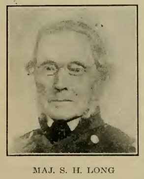
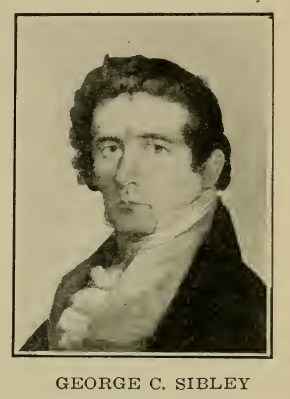 Other Explorations. —George C. Sibley, U. S. Indian agent at Fort Osage, on the Missouri, visited the salt plains of the Cimarron and the Salt Fork (Nescatunga) and explored the surrounding region in 1811. In 1819, Maj. William Bradford, with a company of soldiers, explored the valleys of the Poteau and Kiamitia rivers in Southeastern Oklahoma. In 1820, the exploring party under Maj. Stephen H. Long, returning from the Rocky Mountains, passed eastward across Oklahoma, the line of march being bet-ween two branches of the Canadian River. Other Explorations. —George C. Sibley, U. S. Indian agent at Fort Osage, on the Missouri, visited the salt plains of the Cimarron and the Salt Fork (Nescatunga) and explored the surrounding region in 1811. In 1819, Maj. William Bradford, with a company of soldiers, explored the valleys of the Poteau and Kiamitia rivers in Southeastern Oklahoma. In 1820, the exploring party under Maj. Stephen H. Long, returning from the Rocky Mountains, passed eastward across Oklahoma, the line of march being bet-ween two branches of the Canadian River. |
 Boundary Dispute Settled. —February 22, 1819, a treaty was made between Spain and the United States whereby the dispute as to the boundary between the Spanish possessions in Mexico (including Texas at that time) and the Louisiana country (which had been purchased from France by the United States) was finally settled. The channel of the Red River westward from the 94th meridian to the 100th meridian, thence following the latter meridian northward to the Arkansas River, formed a part of the boundary. The boundary thus fixed still marks the division between the states of Oklahoma and Texas except the line which bounds Bewer, Cimarron and Texas counties on the south. Boundary Dispute Settled. —February 22, 1819, a treaty was made between Spain and the United States whereby the dispute as to the boundary between the Spanish possessions in Mexico (including Texas at that time) and the Louisiana country (which had been purchased from France by the United States) was finally settled. The channel of the Red River westward from the 94th meridian to the 100th meridian, thence following the latter meridian northward to the Arkansas River, formed a part of the boundary. The boundary thus fixed still marks the division between the states of Oklahoma and Texas except the line which bounds Bewer, Cimarron and Texas counties on the south. |
| Tecumseh in Oklahoma. —In the early part of 1811, Te-cumseh, the great war chief of the Shawnees, visited the Osage Indians in Northeastern Oklahoma and tried to secure their help in combining all of the Indian tribes to resist the further advance of the white settlers. The Osages were greatly impressed by the eloquent words of Tecumseh, but they declined to join his movement to fight the white man. |
| The First Military Posts.— In 1817, the Government established a military post at Belle Point, a picturesque spot immediately below the mouth of the Poteau River and |
 |
| OFFICERS’ QUARTERS, FORT GIBSON |
therefore adjoining the eastern boundary of the present state of Oklahoma. This post was named Fort Smith. Seven years later, in April, 1824, Col. Matthew Arbuckle, of the 7th U. S. Infantry, selected the site of another military post on the eastern bank of the Grand (or Neosho) River and a short distance above its mouth. This post was named Cantonment Gibson. A month later, the site for still another military post was selected by Colonel Arbuckle in the valley of the Kiamitia a few miles above its mouth. This post was called Cantonment Towson.
Cantonment Gibson later became known as Fort Gibson. It was named for Col. George Gibson, at that time and for many years afterward at the head of the subsistence department of the U. S. Army. It was a garrisoned post almost continuously for nearly seventy years. The original post consisted of hewed log buildings surrounded by a palisade of logs set on end in the ground and loop-holed for defensive fire, with log block-houses at the corners. This post was situated in the valley, close to the river bank. Subsequently the building of a new post was undertaken and the few remaining buildings are those of frame and stone which stand on Garrison Hill, overlooking the site of the first post. It was long the station of the regimental headquarters, was situated near the agencies of the Cherokee, Creek, Choctaw and Osage tribes of Indians and was a center of social as well as official life in the Indian Territory. Visitors to the Indian country never failed to call at Fort Gibson. Many noted men of the last century were guests within its hospitable quarters. Among these might be mentioned Washington Irving, George Catlin (the painter of Indian portraits and scenes), John Howard Payne (the author of “Home, Sweet Home”), and J. M. Stanley (artist). Among the noted military men who were stationed there as officers at various times might be mentioned Jefferson Davis, David Hunter, Philip St. George Cooke, Stephen Kearney, Edwin V. Summer, Braxton Bragg, D. H. Eucker and others whose names were destined to be known to fame. The Cherokee Indians long objected to the maintenance of a military post in their widst and, finally, in 1857, it was abandoned and the garrison was withdrawn. It was re-occupied during the Civil War, first by the Confederate forces and afterward by those of the Federal Army, eventually becoming the center of Union operations for the surrounding region. Fort Gibson was finally abandoned as a military station in 1891. The town of Fort Gibson, which is the oldest continuous settlement in Oklahoma, occupies the site upon which the post was built. |
| Indian Wars. —Although other parts of the United States had Indian wars, especially between 1811 and 1815, the only Indian war in Oklahoma during this period, of which there is any record, was the one between the Osage Indians and the Cherokees of Arkansas. |
| First Indian Mission and School Established. —In 1820 a mission and school was established for the Osage Indians in the valley of the Grand (or Neosho) River, near the town of Chouteau, in Mayes County. It was under the patronage and control of the United Missionary Society and was called the Union Mission. This was the first missionary station and the first school in Oklahoma. This mission was operated until 1836. |
| Arkansas Territory Organized. —The territory of Arkansas was created by act of Congress, March 2, 1819. Its limits included not only all of the present state of Arkansas, but also nearly all of Oklahoma as far west as the 100th meridian. |
| Arkansas Jurisdiction. —That part of Oklahoma north of 36° 30’ was not included in the territory of Arkansas. At different times between 1819 and 1829, the territorial legislative assembly of Arkansas defined the boundaries of counties in the wilderness which was afterward included in the limits of the Cherokee, Creek and Choctaw nations. |
| The Migration of the Indian Tribes. —There were several causes which brought about the removal of the Indian tribes from their old homes, east of the Mississippi River, to the western wilderness which afterward became known as the Indian Territory. In the first place, many of the Indians had become so dissatisfied with the white settlers, who were crowding about them on all sides, that they were not only willing but anxious to move to a place where they would be free from such surroundings. Then, too, the Government wished to have the Indians located where their affairs could be managed with the least possible interference from troublesome white people. Finally, the missionaries, who were laboring to convert the Indians to Christianity and to help them to adopt the ways of civilization, urged that the Indians be taken so far into the wilderness that they would be beyond the reach and unwholesome influence of dishonest white traders and whiskey sellers who were the cause of so much of the trouble and unhappiness of the Indians. For these reasons, the Government undertook to secure treaties with the Indians whereby they would agree to remove west of the Mississippi. There were a number of treaties entered into between the Government and the Cherokee, Choctaw, Chickasaw, Creek and Seminole tribes between 1825 and 1835 for this purpose. |
| The Fur Trade. —The fur trade continued much as it had been during the latter part of the previous period. However, American traders began to come in and compete with the Creole French traders who had so long controlled the trade of this entire region. |
| The First Indian Reservation in Oklahoma. —By the terms of the first treaty for the removal of the Choctaw Indians, October 20, 1820, they were to give up all their tribal lands in Mississippi and in return were to receive a grant of all the lands lying between the Canadian and Red rivers in the western part of the (then) territory of Arkansas. This was the first tract set aside as an Indian reservation within the limits of the present state of Oklahoma. |
| Summary. —This period in the history of Oklahoma was largely devoted to exploration by Americans. This, together with the establishment of several military posts and new trading stations and one mission helped to pwe the way for the settlement of the tribes from east of the Mississippi which was soon to follow. There were no Indian wars of consequence in Oklahoma during this period, though Te-cumseh endewored to incite one. |
SUGGESTIVE QUESTIONS
Second Period. |
| 1. Who was the first American to attempt to explore Oklahoma? Why did he turn back without completing his mission? |
| 2. Who descended the Arkansas Eiver in 1806? What part of Oklahoma did he pass through in the course of his journey? What other explorers visited Oklahoma during this period? |
| 3. When was Fort Smith established? Fort Gibson? Fort Towson? Give the location of each of these posts. |
| 4. When and how was the western boundary of Oklahoma determined? What foreign nation claimed the territory that bordered upon Southern and Western Oklahoma at that time? |
| 5. For what tribe of Indians was the first mission and school established in Oklahoma? When and where was it established and what was it called? |
| 6. What can you tell of the fur trade in Oklahoma during this period? Did the French traders continue to control the fur trade? |
| 7. What noted Indian leader visited Oklahoma in 1811? For what purpose did he come? Did he succeed? |
| 8. When was it first proposed to establish an Indian Territory? |